
Photos of cracked walls, old doorsteps and a church causeway fly across group chats. The map shows only open water. The stories talk of bells beneath the waves. What really survives under Ladybower is stranger and sadder than a campfire tale, yet no less magnetic.
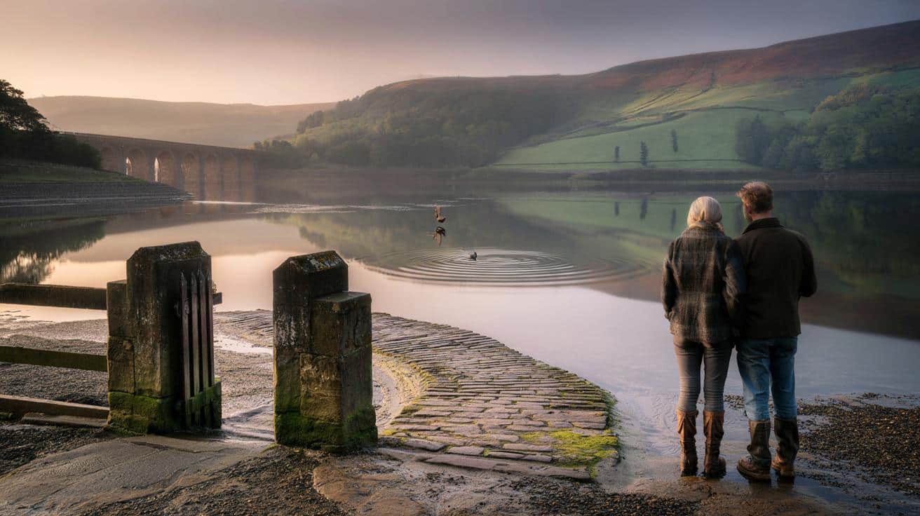
I stood on the shingle where the lane drops into Ladybower, the air sour-sweet with algae and rust. Early light slid across the reservoir like a hand smoothing creased sheets. A couple in hiking boots stared at the water in a quiet way that told me they’d come to remember, not just to look.
Somewhere under that greygreen skin lay two villages—Ashopton and Derwent—drowned in the 1940s to slake the thirst of growing cities. A heron lifted, and the surface barely shivered. The silence had a weight to it you could almost pocket.
Then a bell rang.
What disappeared, and why the echoes refuse to
Derwent and Ashopton weren’t myths. They were ordinary English places where school bells rang, bread cooled on sills, and the postman knew which dog to dodge. In the 1930s, engineers planned a new dam to create Ladybower Reservoir. By 1943, residents had gone, roofs were off, and **a village wiped off the map** became a utility project with a deadline.
People like to say the church spire of Derwent still slices the water on low days. Not now. It stood for a while, eerie and needle-thin, until 1947 when it was demolished for safety. Graves were carefully moved uphill to Bamford. The water rose, and with it a rumour that the bells, sunk or not, ring when the wind is from the east. *The facts don’t dull the chill of that idea.*
In drought summers—1976, 1995, 2018, 2022—the lake gasps and the past pokes through. Thousands came in 2022 to tread the old lines of Ashopton’s main street, passing foundations that looked like jawbones. A father lifted his son so he could see a mossed doorstep, the boy asking, “Who lived here?” The lilt of his question clung in the air like smoke. The answer is: bakers, joiners, midwives, and ordinary worry.
The “haunted” tag sticks because absence is noisy. Water edits a place until it’s almost an idea, then drought returns the skeleton and our minds fill in flesh. Sound plays tricks here; wind funnels through the valley, punching notes from taut wires that pass for bells if you want them to. Memory does the rest. What persists isn’t just masonry. It’s the grammar of a life that was rearranged.
How to test the legend against the ground
There’s a neat, practical way to read a drowned landscape. Start with an old Ordnance Survey from the 1930s, then trace the grid onto your phone map. Mark three anchors—church, bridge, main street—so your feet know where your eyes are. Walk the shore at safe, accessible pull-ins near the Ashopton Viaduct and the old packhorse routes, letting lines on paper translate into angles in the land.
Carry one question at a time. Today: the bell. Tomorrow: the bridge. Keep your ears honest by listening at different points, not just where someone on TikTok told you to stop. Let’s be honest: nobody actually does that every day. We’ve all known that moment when you want a story to be true so you lean in—just an inch too far. Step back. Smell the water. Note the wind. Then take the picture.
Visiting at low levels is tempting, yet mud here can be claggy and mean. Rangers ask people not to venture beyond signed paths, especially when the silt looks crusted but isn’t. If you’re chasing the “ghost village,” remember there are families who still bring flowers for names lifted from old headstones. Grief doesn’t sink; it moves.
“Nothing supernatural about it,” a local archivist told me, half-smiling. “Loss has a way of sounding like bells when you don’t know where else to put it.”
- What really happened: Derwent and Ashopton were cleared in the early 1940s; buildings dismantled; church spire demolished in 1947.
- What you can still see: foundations in severe drought, causeways, gateposts, old road lines near the viaducts.
- Where the myth endures: tales of bells, footsteps on vanished bridges, lamps moving across the water on foggy nights.
- How to look: cross-check old maps, speak to locals, visit museums in Bamford or Castleton, and walk with patience.
What the “ghost village” is really telling us
The story of a haunted place is often a story of people trying to hold on. Ladybower doesn’t hide a curse; it holds a compromise. Cities needed water. Villagers needed home. Something had to give, and the lake is what compromise looks like when it fills a valley to the brim.
When heat bakes the Peak and the levels drop, what returns isn’t just scenery. You see planning choices etched into sandstone, and you see how quickly a map can forget what a person can’t. Some swear they hear bells. Some hear nothing at all. Both are hearing England talk to itself about what it trades and what it keeps.
If you feel a shiver on the dam wall, maybe that’s not fear. Maybe it’s recognition. The disappeared have a way of showing up when the light is strange and your phone’s in your pocket. The lake glints. The present tightens its grip. Somewhere below, history keeps breathing.
| Key point | Detail | Interest for the reader |
|---|---|---|
| — | Derwent and Ashopton were flooded in the 1940s to form Ladybower | Sets the factual spine beneath the legend |
| — | Church spire demolished in 1947; graves moved to Bamford | Explains the bell myth and what physically remains |
| — | Drought years reveal streets, walls, and causeways | When and where to look if you want to “meet” the ghost village |
FAQ :
- Are the bells of Derwent really under the water?Most were removed before flooding; the persistent “ringing” is more likely wind on wires or wave action echoing in the valley.
- Can you visit the remains safely?Yes, from marked paths near the viaducts in low water, but silt can be treacherous and access changes with conditions.
- When do the ruins appear?After prolonged dry spells. The most notable sightings were in 1976, 1995, 2018 and 2022.
- What happened to the villagers?Families were relocated, some to new council houses; headstones were moved to a churchyard at Bamford.
- Is the site actually haunted?There are plenty of stories—lamps on foggy nights, footsteps on vanished bridges—but no evidence beyond folklore and feeling.


Got goosebumps at “the silence had a weight you could almost pocket.” Visited Ladybower last year; thought I heard a bell—probly just wind on wires, but still. The way you tie maps to footsteps is brill. Thank you for treating it with care. 😊🙂
Chilling, but is there any verifiable audio of the ‘bells’ synced with wind direction data?