
UK weather charts are shading in colder colours across the top half of the country, and that’s where the risk sharpens: fresh snow for northern hills, with lowland flurries trying their luck.
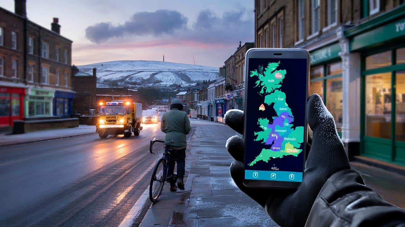
I was standing on a quiet street in Leeds just after dawn, watching the glow from a shopfront bathe the slick pavement. A gritter hummed past, amber lights twirling like a carnival ride, and a delivery cyclist lifted his chin to taste the air. You start noticing the tiny tells — the way breath hangs longer, the way tyres hiss, the way everyone glances down at their phones for that freshly-updated map. Across the screen, the colours deepened from teal to blue to purple as the showers lined up in the North Sea and swam inland. I had the strange feeling that the weather was drawing a line we’d all have to cross. A single band could make a morning.
Snow risk creeping south across the hills
Fresh model runs and live radar snapshots are pointing to a corridor of wintry showers feeding the north and east. The maps show fingers of blue nudging across North Sea coasts, then fattening over high ground — the Cairngorms, the Grampians, the Cheviots, the Pennines. The message is plain in colour: colder air settling in, with a freezing level dipping towards 300–400 metres and the line wiggling lower overnight. That’s where **fresh snowfall risk** concentrates — upland routes first, then marginal slush for the towns beneath.
Take the A9 over Drumochter or the A66 over Stainmore and you can almost sketch the risk by memory. Showers scrape off the North Sea, pick up a touch of energy over warmer water, then spill west and climb. A narrow shower line can flip from rain to snow within a mile as it hits an escarpment, and people find out the hard way at the next lay-by. A farmer near Rothbury told me he checks the radar more than his watch on days like this, because the bright blues “behave like sheepdogs” for the flurries.
There’s a simple logic at work. We’re in a polar-maritime setup, with colder air pooling over the north and a feed off the North Sea boosting convection. The maps reflect the tug-of-war between elevation and temperature: each 100 metres matters, and so does the time of day. Late nights and early mornings lower the snow line; daytime bumps it back up. Coastal strips are likely to stay wet, while the inland ridges gather flakes like quiet collectors.
Reading the maps and planning your day
Think in layers. Check the precipitation radar first, then layer on temperature and a contour map, then wind direction. If the colours are vivid over the North Sea and drifting onshore from the northeast, track where the hills start — that’s your first risk zone for settling snow. Use **hour-by-hour radar** loops, not a single frame, and watch for persistent streamer lines that refuse to wander.
Two common traps trip people up. One is trusting a broad-brush forecast over what your eyes and local topography are telling you. The other is underestimating how a 2°C reading can still give wet snow at the top of your road if it sits 150 metres higher. We’ve all had that moment when a sunny patch fools us into leaving the hat and gloves at home. Let’s be honest: nobody really checks elevation data on a school run, but it can save a slip and a wasted detour.
The small rituals help: set alerts for your specific route, peek at roadside cameras on key passes, and keep a plan B. The difference between a slushy shower and a pre-dawn whiteout can be ten minutes and a mile.
“Snow doesn’t fall evenly. It hunts edges — coastlines, ridges, river valleys — and that’s exactly where people make quick choices,” said a mountain rescue volunteer in the Borders.
- Look for persistent shower bands on the coast that align with your commute direction.
- Note the freezing level shared on forecast maps; subtract 1°C for exposed ridges.
- Check live cams for the A9, A66, M62 tops before setting off.
- Carry a small kit: scraper, torch, warm layer, phone charger.
What this spell could mean next
Map after map is hinting at a see-saw week where the north leads the dance. The takeaway isn’t panic, it’s pacing: a period where the uplands collect and release, where showers cluster in familiar corridors, where nights bring the snow line down to the village edge. The pattern could change on a dime if a trough deepens or the wind swings, and the colours will tell the story in real time. You’ll see the line of blues tighten or loosen, and you’ll know what it means for your school run, your shift, your late bus home. **Northern hills** love a surprise; they tend to share it with the valleys by morning.
On the ground, it translates to something both ordinary and a little magical. Pavements squeak at first light, roofs wear frosted caps, and headlights paint the snow into sudden theatre on the bends. The risk is real on high routes and untreated side streets, but so is the simple hush of first flakes in a beam of light. You don’t need a blizzard to change a mood — one stubborn band can do it.
Forecast confidence sits on a sliding scale. Radar is your best friend at short range, model charts your guide out to a day or two, and beyond that it’s all about pattern-watching. If the feed stays on a north to northeast line, the same communities will see repeat hits; if it tilts easterly, the axis shifts, and more of Yorkshire and County Durham get a turn. Watch how those blues bend around the Pennines. That curve is the difference between a wet dog walk and a proper snowball.
Practical moves when the colours turn colder
Start with your personal map. Drop pins on your regular crossings — the hill out of town, the exposed roundabout, the shortcut under the railway. On a day with biting onshore flow, test the route with a preview step: walk to the corner, check the wind on your face, gauge the wetness of the air, then decide on boots or trainers. Small choices early keep everything simple later.
Avoid the hero run. If the radar shows a persistent streamer over the M62 tops, duck south or delay; if the A9 is flickering between blue and purple, consider a coffee and a second look at the cameras. There’s no prize for being the first car into the queue on the summit. I get how plans feel fixed, and how easy it is to think “it’ll be fine”. These are the days where a 15-minute tweak saves an hour of spin and a call to a tow truck.
For families and carers, prepare the tiny margins: move the alarm five minutes earlier, lay out the warm layers, put a scraper by the door. A calmer start changes the whole journey.
“We treat every passing shower like it’s the one that sticks,” said a veteran gritter in Cumbria. “That mindset keeps roads open.”
- Top up washer fluid and keep a de-icer in the glovebox.
- Set a location-based alert on your weather app for hills along your route.
- Share live location if you’re crossing uplands after dark.
- If you work outdoors, rotate tasks to match the lulls between bands.
A northern spell that invites small, smart changes
Weather maps can feel abstract until the colours step off the screen and onto your street. This week’s pattern invites a more local way of looking: street by street, hill by hill, hour by hour. It’s not a blockbuster storm, more a steady drumbeat where the north takes the lead and the rest of us listen in. The choices are ordinary, not heroic — an earlier start, a warmer layer, a fresher look at the radar loop, a call to a neighbour who parks on the ridge. If you live under the streamer lines, the routine becomes a kind of rhythm. If you don’t, you’ll still sense the hush in the air when the wind nudges round and the colours deepen. Either way, the maps are a quiet nudge to slow down and look closely at familiar places, and that’s worth sharing.
| Key point | Detail | Interest for the reader |
|---|---|---|
| Snow risk focuses on elevation | Freezing level around 300–400 m, lower overnight | Explains why upland routes turn tricky first |
| Streamer lines matter | North/Northeast winds feed persistent coastal bands inland | Helps predict which towns see repeat flurries |
| Plan by route, not postcode | Use radar loops, cams, and known pinch points (A9, A66, M62) | Reduces delays and last-minute scrambles |
FAQ :
- Where is most at risk of settling snow?Upland parts of Scotland, the Pennines, Northumberland and the higher stretches of Cumbria are first in line, with lowland slush possible beneath persistent bands.
- Will it stick in cities?Urban centres near the coast will likely see sleety showers, but brief settling is possible overnight on grassy surfaces if a heavier burst lines up.
- When are the heaviest bursts likely?When shower streamers align on a north to northeast flow and persist for an hour or more, often late evening through early morning.
- Which roads should I watch?The A9 over Drumochter, the A66, the M62 tops, and exposed B-roads over moors can flip to snow quickly during shower peaks.
- How can I track changes fast?Use a live **hour-by-hour radar** loop, toggle temperature layers, and check route cameras — a 10-minute check can change your plan.


That description of colours deepening from teal to purple is spot on — Leeds felt exactly like that at dawn. Thanks for the hour‑by‑hour radar tip; I finally get why the Pennines nab the flakes first. Time to pack a warm layer and a scraper. Stay safe up there! 🙂